
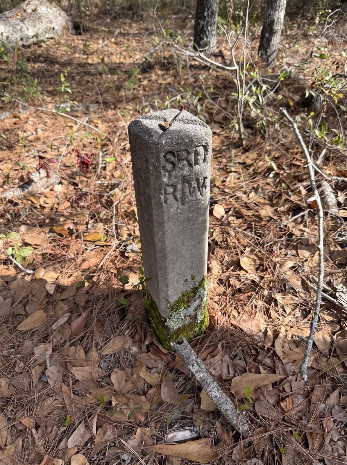
You can be walking along an old railroad bed, a forgotten trail, or what looks like nothing more than an ordinary path through the woods. You aren’t expecting much. Maybe a few old stones. Maybe some rusted metal. And then, almost hidden in the weeds, you notice a knee-high concrete post sitting by itself.
At first glance, it doesn’t look like much.
But that’s exactly what makes it fascinating.
A simple concrete marker like this can be a clue to an entire piece of local transportation history. It may have once marked the boundary of a state-maintained road corridor, identifying where the official right of way began or ended.
And suddenly, that little post isn’t just a piece of concrete anymore.
It’s evidence.
What Is This Concrete Marker?
The marker appears to be a State Road Department right-of-way marker, often associated with the abbreviation “R/W,” meaning “right of way.”
In simple terms, it was used to identify the official boundary of a road corridor.
That might sound rather technical, but think about what that means.
A road had to be surveyed. Property boundaries had to be established. Land had to be acquired or designated for transportation use. Engineers and road crews had to know where the public road property ended and private property began.
A little marker could help establish that boundary.
So when you stumble across one beside an old roadbed, you’re potentially looking at a physical reminder of all that planning and construction.
Why Would a Road Marker Be Sitting Out Here?
This is where things get really interesting.
Old roads don’t always disappear completely.
Sometimes a road is abandoned because a newer route provides a better connection. Sometimes traffic patterns change. A bridge becomes obsolete. A road is straightened, widened, relocated, or replaced.
Eventually, maintenance stops.
Grass grows through the surface. Shrubs take over the shoulders. Trees begin growing where cars once traveled.
Give it enough time and a former road can become surprisingly difficult to recognize.
But concrete is stubborn.
A marker that was installed decades ago may remain standing long after the pavement, road signs, drainage features, and other obvious clues have disappeared.
That’s why finding one can feel like discovering a tiny time capsule.
What Does “R/W” Mean?
The abbreviation R/W generally means right of way.
A right of way is the legally established area used for transportation or another permitted purpose. In the case of a public road, it defines the corridor within which the road and related infrastructure can exist.
The important thing to remember is that the marker doesn’t necessarily tell you where the pavement itself was located.
It can indicate the boundary of the larger road property or corridor.
That distinction is easy to miss when you’re standing beside an old road.
Why These Markers Are So Fascinating
Large historic objects tend to announce themselves.
An old bridge?
You notice it.
A railroad station?
You notice it.
A historic building?
Absolutely.
But a small concrete post beside an overgrown path?
That can be incredibly easy to walk right past.
And that’s what I love about it.
The object doesn’t look important until you understand what it represents.
Once you know what you’re looking at, the landscape starts telling a different story.
